In the current years of technology, no one can imagine how their smartphones are integrated into their daily lives. Google has transformed the geographical data in its program Google Earth to watch the images of the earth through satellite.
Google Earth manages to facilitate users with 3D images of streets and historical buildings without leaving home.
Our cell phones use GPS technology, therefore, if you want to find the location of your family member. You can track cell phone number location using Google earth without knowing them.
Part 1: What is Google Earth?
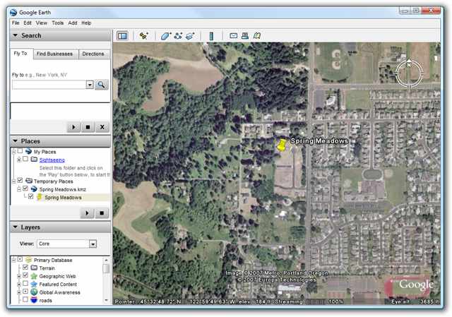
Google Earth is a computer program that provides a 3D demonstration of the earth based on satellite images. It generates a map of the earth with the help of aerial photos, satellite images, and GIS data in the shape of a 3D globe.
- This globe allows users to see the cities and historical places from different angles.
- The program allows the users to see their place by entering the address and coordinates using a keyboard or mouse.
- Users can also download this program on their smartphone or other portable devices and navigate using touch screens.
- Google Earth allows users to add their own data with the help of Keyhole Markup Language and upload it through various mediums like blogs or forums.
- This software is capable of showing different types of high-resolution images taken from a satellite.
Moreover, Google Earth provides a lot of other useful tools. Let’s take a quick look at them.
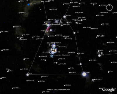
1. Google Sky
Google introduced Google Sky based on augmented reality features that allow users to see the stars and other astronomic bodies. It starts this program in collaboration with the Space Telescope Science Institute (STScI).
2. Google Mars
Google mars program can take images of the planet Mars supported by Google Earth. Google also introduced a browser-based version, but the maps consist of high-resolution images and also include 3D terrain, infrared images and elevation data.
The images included in Google Mars are taken with extremely high-resolution Mars Reconnaissance Orbiter’s HiRISE camera that is similar to that of Google Earth. It provides the same resolution that is used for street view through satellite.
There are various high-resolution panoramic images available on Google Mars from different Mars landers. For example, Mars exploration rovers, opportunity and spirit that users can see in a similar way as Google street view.
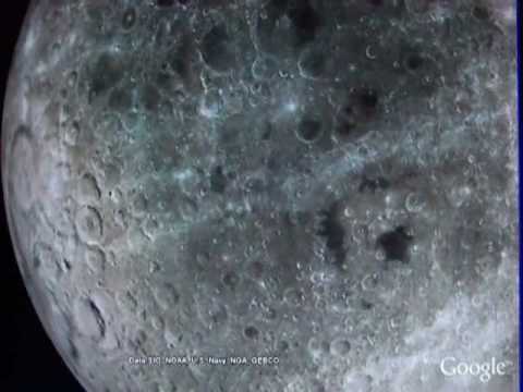
3. Google Moon
Here is another fantastic feature of Google Earth with the name Google Moon that is used to explore the surface of the Moon. Google introduced this feature in the mid of 2009 at the event of the 40th anniversary of the Apollo 11 mission.
NASA provides information for incorporating maps, videos, and panoramas for street view style. It includes multiple tours including Apollo mission.
Part 2: How Does Google Earth Work?
Google Earth is a geo-mapping and tagging program that compiles a set of images taken from the satellite in one place to form a comprehensive and interactive earth map.
This program provides 3D images of the earth taken from satellites and millions of people use this information and images to discover unknown geographic location, and track climate changes and different ecological features.
It is free to use through different mediums like Windows, iOS, Android, and Linux devices. This digital cartography tool is useful for people who want detailed geographical data. It is also helpful for environmentalists to keep an eye on the movement of flora and fauna around the world.
There is a wide range of functions attached to Google earth along with Google map services like Google satellite phone tracker, 360 degrees street shots, and aerial shots.
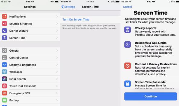
- Step 1: Go to Settings >Screen Time.
- Step 2: Enable this function, then select “This is My iPhone”.
- Step 3: You will find four settings, select the second one “App Limits”.
- Step 4: Simply tap on “Add Limit”, select the apps you want to block and then set up the time to use it.
Part 3: How to Track a Cell Phone Using Google Earth?
In this world of technology, Google enables users to take advantage of the latest technologies in a simple way. Google Earth GPS tracking cell phone feature allows users to track the current location of their loved ones.
It also allows users to share their current location. Besides, users can also see the progress location changing to determine the estimated time of arrival.
Its latitude is the latest addition to this advanced mapping system that is capable of tracking the location with the help of a smartphone. Follow the simple steps to track an Android phone using Google Earth.
- Step 1: Visit Google’s Latitude website and log in with your Google account. www.google.com/latitude
- Step 2: After login, you will find the box requiring the cell phone number, enter your number there. Then press the send button, and you will receive a link in the text message, and expect the cell phone user to accept the latitude.
- Step 3: Open the link received on your cell phone to visit the Google Latitude website. Make sure that data on a cell phone is enabled or connected with a Wi-Fi connection to operate a web browser on the mobile phone. After the opening of the invitation, the link allows Google to monitor your location.
If you want to know how to track my wife using Google Earth, then you have to follow the same procedure and allow the location is sharing from your wife’s cell phone to your cell phone.
Note: Note that Google only tracks your phone only if it remains in contact with Google Latitude and this requires an internet connection or data accessibility all the time.
Part 4: Software Similar to Google Earth Cell Phone Tracker
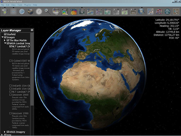
1. WorldWind
It is open-source software working under licensed by NOSA. It is initially established by NASA’s learning technologies project. This program allows the users to view the earth with a zoom option similar to that of Google Earth. It is free to use this software.
WorldWind also uses imagery and elevation data from a satellite that allows the users to view 3D images with high resolution.
2. Marble
Marble is another small interactive virtual globe and allows the users to learn more about the earth. Just like a conventional globe or real atlas, Marble makes it easy to move over the map freely and sees different places with zoom options.
A Marble aims to provide more flexible services beyond its cross-platform design, and it is straightforward to integrate various core components in other programs. Besides, it is equipped with a variety of features that enable the users to view the earth from different angles.
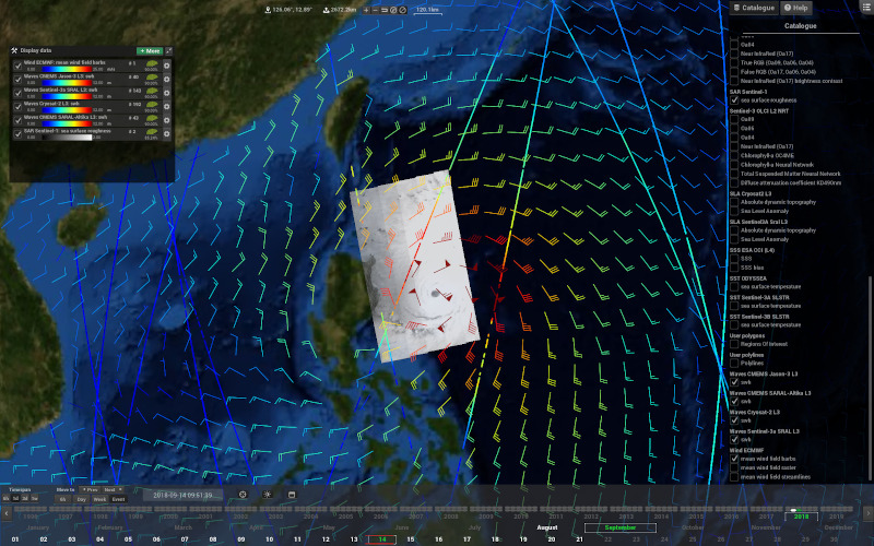
3. Virtual Ocean
Virtual Ocean incorporates the GeoMapApp tool that is compatible with the NASA World Wind 3D earth browser for creating a powerful platform to support different educational and research programs. Some of the core features of this program are:
- Users can explore different 3D images both under the sea and over the earth environments.
- It provides access to many scientific datasets.
- Terrestrial visualizations.
- General data viewers.
- Custom data viewers.
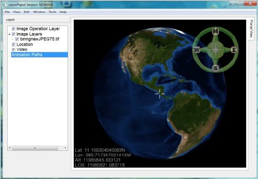
4. ossimPlanet
ossimPlanet is one of the most accurate 3D viewers that is designed on the top of OpenSceneGraph, OSSIM, and Qt open-source software libraries.
This software is capable of providing access to data with different formats from government and commercial organizations with high-performance visualization and collaboration capabilities.
Here are some core features of this program.
- Remote collaboration.
- Double precision 3D accuracy.
- OGC WMS interfaces.
- Elevation data sets.
- KML/KMZ support.
- Native file access.
- Access data directly from the NASA WorldWind server.
Conclusion
In the above article, we have discussed different useful information about Google Earth and the process of tracking cell phones with this program. Google just started from a simple mapping program and provided Ariel images as well as for earth but also for other planets like the moon and mars. This program is useful to track cell phones but only after completing the process mentioned above.
-
Home >
-
Tips >
- How to Use Google Earth Cell Phone Tracking